

Rock Road Ferry, St. Genevieve, Missouri, October 23, 2019
3N8° 00’ 15” W90° 03’ 33”, Elevation 390 feet
A willow tree bends over the water that feeds its roots. A willow can survive a long time with its roots under water. In most other years, this tree would have had wet feet for a few months in the spring as snow melt and spring rains raised the water level. This year, the Mississippi River has remained high since April and is over flood stage in October. Today, the boat dock is submerged and the ferry closed due to high water. The grain mill at Modoc, Illinois, is visible across the river.

Southeast Missouri Port, Scott City, Missouri, October 24, 2019
N37° 14’ 54” W89° 29’ 49”, Elevation 360 feet
The blue-and-white cairn rests at the end of the River Road where the La Croix Creek and the Mississippi River converge, drawing attention to the river as a transportation asset, moving crops and materials. The Southeast Missouri Regional Port Authority’s website notes that the port offers slackwater harbor, public terminals, interstate highway access, switching railroad (UP, BNSF), industrial sites, complete utilities, and much more.

Trail of Tears State Park, Cape Girardeau, Missouri, October 23, 2019
N37° 27’ 13” W89° 27’ 41”, Elevation 370 ft.
In 1830, President Andrew Jackson signed the Indian Removal Act. Because of this law,16,000 Cherokee people were forced to travel from their homes east of the Mississippi to Oklahoma in the winter of 1838-39. Ice on the Mississippi compelled the caravans to camp in Cape Girardeau County. Harsh winter weather, lack of food, and illness caused the death of more than 4,000 Native Americans on that Journey commemorated here at the Trail of Tears State Park and across the river in the Trail of Tears State Forest in Illinois.

Trail of Tears State Park, Cape Girardeau, Missouri, October 24, 2019
N37° 27’ 23” W89° 28’ 45”, Elevation 690 feet
Trail of Tears State Park honors the 800-mile forced relocation of 16,000 Cherokee people, from their homes east of the river to reservations in the West. More that 4,000 died in the Cape Girardeau County winter of 1838-39. The crystal cairn overlooks the park’s Vancill Hollow Nature Area and the Mississippi.

Grand Tower, Illinois, July 15, 2020
N37° 37’ 50” W89° 30’ 22”, Elevation 340 feet
The grand tower cairn glows in the setting sun on the riverbank near the Mississippi River Museum on Front Street in Grand Tower, Illinois. The cairn’s site is directly across the Ohio River from Tower Rock (not seen in this image). The 400 million year old Limestone rock protrudes 60 feet above the water narrowing the river channel to treacherous currents. The rock was a landmark for native people and mentioned in the writings of early explorers. Now part of the Tower Rock Conservation Area in Perry County, Missouri, the rock was listed on the National Register of Historic Places in 1970.

Rock Road Ferry, St. Genevieve, Missouri, October 23, 2019
37° 57’ 6.13”N 89° 55’ 36.4”W, Elevation 390 feet
A willow tree bends over the water that feeds its roots. A willow can survive a long time with its roots under water. In most other years, this tree would have had wet feet for a few months in the spring as snow melt and spring rains raised the water level. This year, the Mississippi River has remained high since April and is over flood stage in October. Today, the boat dock is submerged and the ferry closed due to high water. The grain mill at Modoc, Illinois, is visible across the river.

West Paducah, Kentucky, July 16, 2020
N37° 08’ 23” W88° 44’ 43”, Elevation 310 feet
The map labels this site adjacent to the bridge from Illinois as “Metropolis Ferry.” At one time, there may have been a ferry carrying passengers to Metropolis, Illinois, on the other side of the Ohio river, but all that remains is a gravel road to the river on both riverbanks. Rocket Ship cairn sits in the calm water with the smokestack of Honeywell Corporation’s Metropolis plant in the distance.

Cairo, Illinois, July 16, 2020
N36° 59’ 03” W89° 08’ 26” W, Elevation 320 feet
The capacious (capable of holding much) cairn was created for this point where the Ohio River meets the Mississippi River because the great volume of water the Ohio River discharges makes it the third largest river in the United States and the Mississippi River’s largest tributary. The Ohio River watershed is home to major cities and industries that send barges full of oil, steel and other industrial goods into the Mississippi.

Tywappity Street, Commerce, Missouri, July 20, 2021
N37°09'25" W89°26'41, Elevation 350 feet
Commerce is a village of sixty-five people on the Mississippi River where several houses had these four-foot-tall concrete walls with solid metal gates at the edge of their yards. South of Commerce 1,607 miles of levees on both sides of the river were built to protect homes and farms while deepening the river channel for shipping. Studies show that they have contributed to flooding damage.

Birds Point Levee Road, Charleston, Missouri, July 20, 2021
N36°57'51" W89°07'37", Elevation 320 feet
Birds Blue Hole is a public fishing site managed by the Missouri Department of Conservation in the Birds Point Floodway, agricultural land separated from the Mississippi River by fifty-six miles of primary levees and thirty-six miles of secondary levees between Birds Point and New Madrid, Missouri. The levees are constructed and maintained by the US Army Corps of Engineers. The Birds Point Levees were part of the 1928 flood control plan to reduce flooding in Cairo, Illinois, and in other river communities. The Army Corps updated the plan several times, but Congress has declined to fund recommended improvements. The Corps has purposefully blasted holes in the levees only twice: during the major floods of 1937 and 2011 to flood farmland to save the towns.

Highway 303 and Birds Point Levee access road, Ohio Township, Missouri , July 20, 2021
N36°54'43" W 89°07'21", Elevation 320 feet
This river access area near the Birds Point Levee is managed by the Missouri Department of Conservation; the flood control stuctures are maintained by the US Army Corps of Engineers. The Birds Point Levee separates the Mississippi River from the adjacent farmlands. It has been purposefully breached only during the major floods of 1937 and 2011 to reduce flooding downstream in Cairo, Illinois.

Missouri Department of Conservation River Access on the Birds Point Levee, off highway 80, East Prairie, Missouri.July 20, 2021
N36°46'25" W89°10'44", Elevation 330 feet
A white cairn rests in front of a stump with the Birds Point Levee in the background. The Birds Point Levee separates the Mississippi River from the adjacent farmlands. It has been purposefully breached only during the major floods of 1937 and 2011 to reduce flooding in Cairo, Illinois, and other downstream communities.

Charleston, Missouri, July 20, 2021
N36°46'15" W89°07'20", Elevation 320 feet
Twilight encloses the black-glass False Gods Cairn at Fitzgerald Marine Repair, located on the Mississippi River off Highway 80 in Mississippi Township, Missouri.

Intersection of Highways 510/107 and 77, near Dorena, Missouri July 20, 2021
N36°36' 60" W89°14'11", Elevation 320 feet
As the sun sets, a glowing Rocket Shop Cairn is framed by the remnants or an agricultural building in the former James Bayou Township. The first government levee to breech in the massive 1927 Mississippi River flood was at Dorena.

Riverfront Park, New Madrid, Missouri, July 21, 2021
N36°35'0" W89°31'56", Elevation 300 feet
The blue-and-white cairn is framed in the opening of this unidentified stone wall in New Madrid Riverfront Park. A billboard not far from this city park humorously declares, “It’s Our Fault,” a reference to the two geological plates pushing against each other deep under the region. It has produced some shaking from time to time and could cause an earthquake at some point in the future. Earthquakes have the potential not only to bring down stone structures but also to alter a river’s course.

Second Street, Century Casino, Caruthersville, Missouri, July 21, 2021
N39°11'29" W89°39'02", Elevation 280 feet
The amber glass cairn sits next to a flood wall, under a giant pipe. The pipe’s function is to pump floodwater that may have seeped to town side of the levee when the flood gates are closed, back into the river. A grain mill located at the river’s edge is in the background of this image.

Tiptonville, Tennessee, July 21, 2021
N36°22'04" W89°30'14", Elevation 290 feet
A giant “ruler” measures the height of the Mississippi River. The United States Army Corps of Engineers, which maintains an official river gage five miles upstream, has records of river levels at Tiptonville since the early 1900s. One of the highest numbers, 44.75 feet over flood stage, was recorded in 1937, the year of destructive flooding on the Mississippi and Ohio River basins. Other highwater years have been 46 feet in 1995 and 1997 and 43.55 feet in 2008. The highest level this year (2021) was 38.11 feet in May.

Reelfoot Lake, Tiptonville, Tennessee, July 21, 2021
N36°22'30" W89°26'07", Elevation 290 feet
Highway 21 follows the lake eastward, circling the Reelfoot State Wildlife Management Area, Reelfoot Lake State Park, and the Reelfoot National Wildlife Refuge. An egret floated in the shallow water between the cypress trees in the distance until the artists disturbed its solitude when placing this cairn.
E5A8507 vertical

Hartman, Arkansas, July 21, 2021
N35°59'54" W89°43'59", Elevation 270 feet
This green-and-yellow cairn is located on an unnamed dirt road, separated from the Mississippi River by a few feet of trees and is just 750 feet south of the Missouri-Arkansas border.
E5A8524

North County Road 919, Tomato, Arkansas, July 21, 2021
N35°52'01" W89°47'02", Elevation 250 feet
A black, red, and amber cairn marks Tomato, Arkansas. A farming village with a population of thirty-five people. Tomato is located on a slough, that is, an area of muddy ground or pool. The slough near Tomato extends a half mile eastward to the Mississippi River’s main channel.

Jacksonville Landing near Levee Road, Osceola, Arkansas, July 21, 2021
N35°43'10" W89°57'35", Elevation 255 feet
Clouds and tree branches played hide-and-seek with the sunlight to momentarily illuminate the tree trunk and the Rocket Ship Cairn at Jacksonville Landing on the Mississippi River.

County Road 1212 crossing Frenchmans Bayou, Arkansas
July 21, 2021, N35°27'58" W90°10'52", Elevation 220 feet
With daylight fading, a thin part of the White Cairn balances on the bridge railing on this quiet country road.
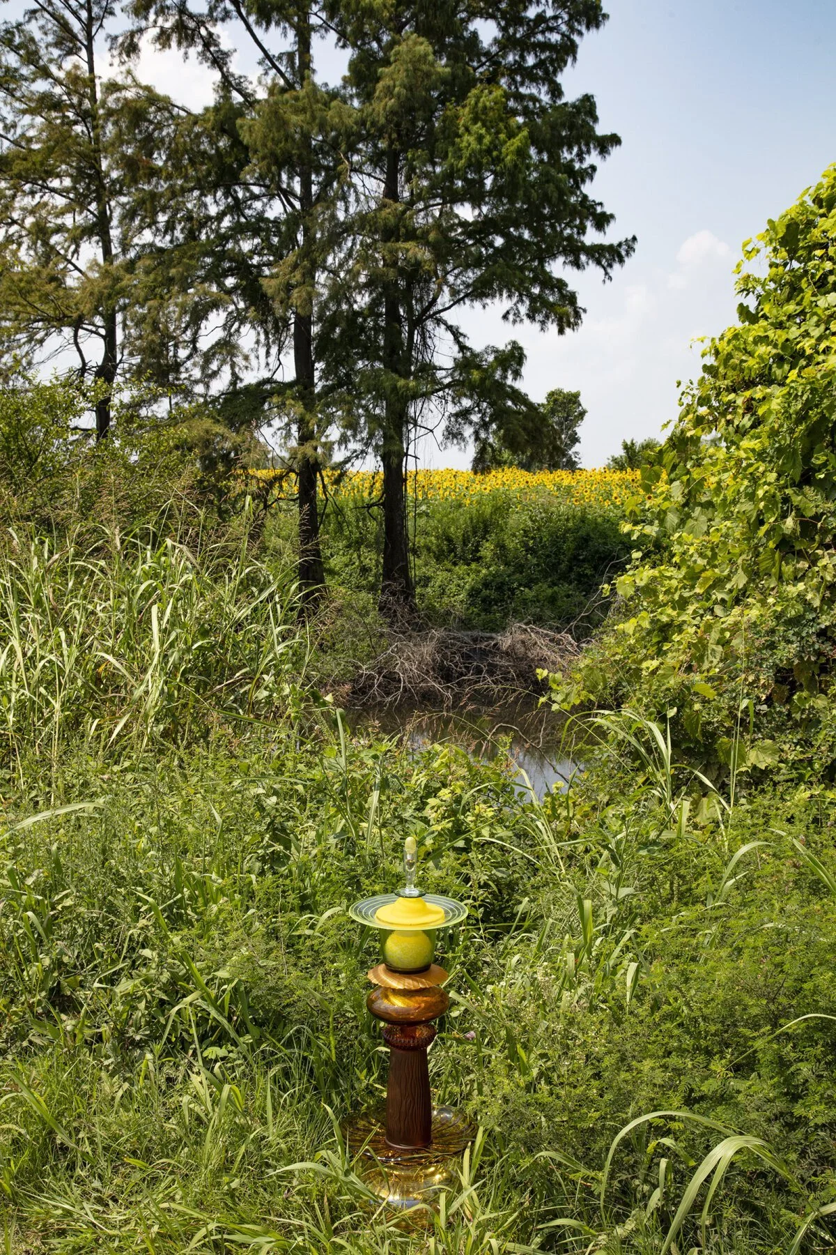
Ballard Slough Road, Tipton County, Tennessee, July 22, 2021
N35°32'14" W89°53'17", Elevation 230 feet
This cypress slough flows close to the Mississippi River and parallel to the larger Ballard Slough. The sunflower field, between them, in the background of this image, is most likely flooded when the river is high.

Meeman-Shelby Forest State Park, Tennessee, July 22, 2021
N35°22'05" W90°04'38", Elevation 230 feet
Dark clouds moved slowly across the sky, giving way to a few puffy clouds. The sun illuminates native plants and the blue-and-white cairn at the edge of the boat ramp at Meeman-Shelby Forest State Park.

Riverfront Park, Mud Island, Memphis, Tennessee, July 22, 2021
N35°9.5'01"N W90°03.3'30", Elevation 230 feet
Don’t know what they call this well-worn structure in Mud Island Park, but it has a great view of the Hernando de Soto bridge, spanning the Mississippi River between Tennessee and Arkansas. Mud Island is a 3.5 mile-long peninsula that shields downtown Memphis from the rapid flowing Mississippi River. The area was originally developed as a theme park, museum, and concert venue, with a scale model of the Mississippi River as one of the main attractions. (You can rent a paddleboat to float in the swimming pool that represents the Gulf of Mexico at the river’s end.) The park hasn’t lived up to the city’s expectations and requires major reinvestment. A 2019 plan proposed reimagining Mud Island for outdoor activities, such as biking, running, or walking.

Hernando de Soto River Park, north of Lake Cormorant, off Highway 61 in Western DeSoto County, Mississippi, July 22, 2021, N34°57'10" W90°14'45", Elevation 200 feet
A fountain-like cairn marks this boat landing in DeSoto County’s only public access to the Mississippi River. The name of the park and the county (organized in 1836) refer to the Spanish explorer Hernando de Soto who met Mississippian Native Americans living here when he traveled the Mississippi River in 1540 CE.

Flower Lake Camp Road and Levee Road, Tunica County, Mississippi, July 22, 2021
N34°35'55" W90°29'46", Elevation 200 feet
In many places along the lower Mississippi River, the roads on top of the levees separating the river from agricultural land and small communities also serve as secondary connecting roadways. On this Levee Road, above the fields on both sides of the winding Flower Lake Camp Road, the Rocket Ship Cairn is balanced on a metal cattle guard that keeps cattle from roaming beyond their designated pasture.

Across the river from Hollywood Casino, south of Tunica, Louisiana and downstream from Peters Island, Arkansas., July 23, 2021, N34°48'23" W90°28'36", Elevation 200 feet
Occasional red-and-white streamers dangling from tree limbs and a flurry of butterflies mark the dirt roads leading from Lee Road 623 to what the map identifies as Campbell Bar. Outside the frame of this image is a rudimentary boat landing on the main channel of the Mississippi River. Eight trucks were parked in the clearing.

Highway 85/44 near Market Street, Lakeview, Arkansas, July 23, 2021, N34°24'57" W90°47'56", Elevation 190 feet
Cypress trees growing in a horseshoe lake, a remnant of the Mississippi’s long-ago channel, viewed from the boardwalk in Lakeview, sponsored by the Arkansas Fish Department.

Highway 85/44 near Market Street, Lakeview, Arkansas, July 23, 2021 N34°24'57" W90°47'56", Elevation 190 feet
Cypress trees growing in a horseshoe lake, a remnant of the Mississippi’s long-ago channel, viewed from the boardwalk in Lakeview, sponsored by the Arkansas Fish Department.

Mozart, near Watson, Arkansas, July 23, 2021
N34°01'28" W91°04'53", Elevation 160 feet
A large section of this rusty, elevated railroad track has been removed. The remaining track structure continues into the woods that an equally weathered sign suggests is, or was, the “Little Mozart Hunting Club, Posted.” The sign and the thick undergrowth discourage travelers from looking for the nearby confluence of the Arkansas and Mississippi Rivers. An amber cairn with a burned-out bulb marks the location.

Desoto Trail Road, Walnut Grove, Arkansas, July 23, 2021
N34°09'16" W90°47'22", Elevation 170 feet
Bobo-Lara Lane becomes Desoto Trail Road on the Mississippi River side of the levee. At the edge of a swampy horseshoe-shaped lake, a roadside, mushroom-shaped cairn mimics the ripples on the surface of the Big Eddy Lake. The cairn was placed over a culvert that connects the lake with a small stream on the opposite side of the road.

Bolivar Road off Levee Road, North of Lake Bolivar, Benoit, Mississippi, July 24, 2021
N33°39'43" W91°02'47", Elevation 170 feet
This white-and-blue cairn rests next to a small, weathered barn on an unnamed road leading over the levee to private hunting clubs on the Mississippi River.

Highway 1, Greenville, Mississippi, July 24, 2021
N33°30'10" W91°03.5'46", Elevation 130 feet
A white glass cairn and a replica wooden canoe rest near the Winterville Mounds Museum. The museum and grounds are a Mississippi State Park and a National Historic Landmark, managed by the Mississippi Department of Archives and History. In the background of this image, two mounds built by Mississippian culture between 1000 CE and 1400 CE are visible. With twelve remaining Native American mounds and two plazas, this is one of the largest existing mound group in North America.

Bunge Road, south of Delta National Forest, Mayersville, Mississippi, July 24, 2021
N32°55'0" W91°03'23", Elevation 110 feet
The levees running parallel and close to the channel are mostly uninterrupted by roads that would allow access to the river. When roads do go over the levee, they frequently end in private property with gates, or “No Trespassing” signs. That doesn’t mean that the river stays on its designated side. Here the Rocket Cairn (topped with a rock found at the site) poses in front of a small swampy area before the Bunge corporation gate.

Levee Road Under the US 82 Bridge, Shives, Alabama, July 24, 2021, N33°16'46" W91°09'54", Elevation 140 feet
With only four bridges—The fifth, Hernando De Soto bridge at Memphis, Tennessee, was closed for repair—crossing the Mississippi River between the Ohio River at Cairo, Illinois and Vicksburg, Mississippi, this bridge between Greenville, Mississippi and Shives/Lake Village, Arkansas is essential.

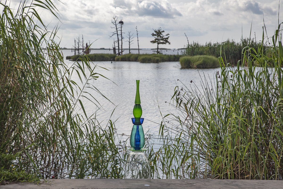
Grand Lake Loop, Grand Lake, Arkansas, July 24, 2021
N33°05'06" W91°12'51", Elevation 110 feet
Broken asphalt and river rocks form the base for these small, clear, quirky cairns. Like the cairns, the dark green shapes of the cypress trees emerging from Grand Lake seem like a dream or fantasy.

Lake Street, Lake Providence, Louisiana, July 24, 2021
N32°48'25" W91°10'29", Elevation 80 feet
A white cairn is balanced on the cypress swamp boardwalk, which is next to the Louisiana Visitors Center.

St. Martin Drive, Delta, Louisiana, across the river from Vicksburg, Mississippi, July 24, 2021
N32°19'57" W90°55'38", Elevation 80 feet
The cairn glows in the last light of the day, in front of a small shimmering pond or slough. Easily missed are the bones of a small animal resting in the left foreground. An alternate title for this image might be “Beasts of the Southern Wild” if that name hadn’t already been claimed by an acclaimed Hollywood film.

Grand Lake Road on the way to Australian Island, Louisiana, July 25, 2021, N32°32'52" W91°03'50", Elevation 100 feet
The native water lilies and cultivated plants coexist in this wet soil.

Letourneau Landing, south of Vicksburg, Mississippi, July 25, 2021, N32°12'02" W90°58'58", Elevation 90 feet
A passing towboat and a blue-and-white cairn mark this popular pleasure-boat landing on the Mississippi River near Vicksburg.

Lake Bruin State Park, St. Joseph, Louisiana, July 25, 2021
N31°57'33" W91°12'09", Elevation 70 feet
Cypress trees draped with Spanish moss are abundant in this Louisiana State Park, near the edge of Lake Bruin, a horseshoe-shaped body of water, once a part of the Mississippi River’s meandering channel. Spanish moss isn’t actually a moss but a bromeliad that gets its nutrients by absorbing what it needs from moist air and dust, not by taking from the tree like a parasite would.

Main Street, Waterproof, Louisiana, July 25, 2021
N31°48'19" W91°22'59", Elevation 70 feet
The blue cairn stands at the corner of a vacant lot and an empty storefront in Waterproof, population 688 in 2010, largely vacant downtown. The water tower proclaims the hope that their town, moved three times since its founding, and now separated from the Mississippi River by an earthen levee, remains waterproof in spite of water seeping under the levees.to erupt as sand and water “volcano” on the land side as they have in the 2011 and 2018 floods.

Natchez, Mississippi, July 25, 2021
N31°34'23" W91°24'01", Elevation 70 feet
This cairn at the foot of the Natchez National Cemetery, situated on the bluff above, marks a quiet view of the Mississippi River and the Highway 84 bridge between Natchez, Mississippi and Vidalia, Louisiana, in the background.

E. E. Wallace Boulevard, Shaw, Louisiana, July 25, 2021
N31°04'13" W91°36'04", Elevation 50 feet
An amber cairn stands next to foundations of an earlier water control structure. The current concrete and steel “low sill” structure, just beyond the trees in this image, is part of the Old River Complex, regulating the amount of Mississippi River water flowing into the Red River, then into the Atchafalaya River. A February 18, 2018, Baton Rouge Advocate article explains, “Without human intervention, the current channel of the Mississippi River would slow to a trickle while the Atchafalaya would swell.” The US Army Corps of Engineers built and manages the Old River Control Complex to ensure that the Mississippi River does not join the Atchafalaya and flow into the Gulf of Mexico, west of New Orleans. This situation would deprive the city of New Orleans of its source of drinking water and literally leave billion-dollar industries and the deepwater Port of New Orleans high and dry.

Deer Park, Louisiana, July 25, 2021
N31°24'57" W91°34'36", Elevation 60
A dozen houses on the old Mississippi River channel are elevated on twenty-foot-tall metal structures to protect them from the seasonal high-water flow. A map shows Mississippi and Louisiana’s boundaries generally following the middle of the Mississippi River. However, there are many places like this where the state boundaries loop away from the present course of the river, showing that the river changed its course since the state boundaries were established. As an example, this house in Louisiana is 4.3 miles west of the Mississippi River, but it is less than one-half mile west of the Mississippi state line.

Lake Mary, Woodville, Mississippi, July 26, 2021
N32°12'02" W90°58'58", Elevation 100 feet
Over the years, backwater flooding from the Mississippi River has deposited silt that has filled Foster’s Lake, the lower reaches of the Buffalo River, and Percy Creek, destroying thousands of acres of timberland, flooding homes and the Lake Mary Road leading to agricultural fields and the Lake Mary recreational area. The owner of a nearby fishing camp explained that area residents are working with their senators and representative to secure funding to restore the drainage and ecosystem.

The intersection of County Road 397 and the River Road, St. Francisville, near Tunica, Louisiana, July 26, 2021
N30°55'28" W91°33'09", Elevation 50 feet
This cairn is photographed in the middle of a county road, a half mile southeast of the Louisiana State Penitentiary. Although it was only late afternoon, the setting recalled the title of a novel set in Savannah, Georgia.

False River Lake, New Roads, Louisiana, July 26, 2021
N30°41'31.7" W91°26.4'12", Elevation 20 feet
The red cairn rests on a lighted bollard on the dock of the False River Paddle Club —closed and for sale. A sign at the entrance to the town of New Roads proclaims it “the prettiest town on the river.” The town is actually located on a lake created when the Mississippi River formed a new channel, leaving a remnant “false river.”

Morganza, Louisiana, July 26, 2021
N30°48'10" W91°37'44", Elevation 60 feet
The four-fifths-mile-long Morganza control structure and the twenty-mile-long, five-foot wide floodway/spillway are managed by the US Army Corps of Engineers to divert excess floodwater from the Mississippi River into the Atchafalaya Basin. This is done to alleviate stress on downstream levees, including those protecting the city of New Orleans. The structure has been opened only three times since it was completed in 1954: in 1973, 2011, and 2019.

East Baton Rouge Parish, Louisiana, July 27, 2021
N30°33'15" W91°12'56", Elevation 40 feet
A huge tractor tire rests on the bank of Mulatto Bay, near the Pine Bluff Sand and Gravel Company, where the Leviathan barge equipped with a crane waits. The wide bay flows between the Mississippi River and Highway 61 before it joins the Mississippi River. The relative openness of this image doesn’t tell the full story of the one and a quarter square mile peninsula behind the quarry served by this landing. About one third is quarry and swamp. The rest is dense with large industrial plants. The industries include PPG Project, ExxonMobile Baton Rouge Polyolefins Plant, Barriere Construction, Deltec Corporation, Agway Systems, Ergon Oil Purchasing, and Kinder -Morgan Bulk Terminals. A compact residential area and Southern University and A&M College are located near the bay’s entrance to the Mississippi River.

The Water Campus, Baton Rouge, Louisiana, July 27, 2021
N30°26'13" W91°11'32", Elevation 40 feet
The deck of the Louisiana State University Coastal Sustainability Studio, on the first floor of the Estuary Conference and Event Venue, is the site of the Rocket Ship Cairn. Overlooking an historic pier, this cairn is featured in three images that illuminate the panoramic view of the river. This building, also known as the Center for Coastal and Deltaic Solutions, is the first phase of Louisiana State University’s 35-acre Water Campus, dedicated to the study of coastal restoration and sustainability in labs, research facilities, and commercial spaces.

The Water Campus, Baton Rouge, Louisiana, July 27, 2021 N30°26'13" W91°11'32", Elevation 40 feet
The deck of the Louisiana State University Coastal Sustainability Studio, on the first floor of the Estuary Conference and Event Venue, is the site of the Rocket Ship Cairn. Overlooking an historic pier, this cairn is featured in three images that illuminate the panoramic view of the river. This building, also known as the Center for Coastal and Deltaic Solutions, is the first phase of Louisiana State University’s 35-acre Water Campus, dedicated to the study of coastal restoration and sustainability in labs, research facilities, and commercial spaces.

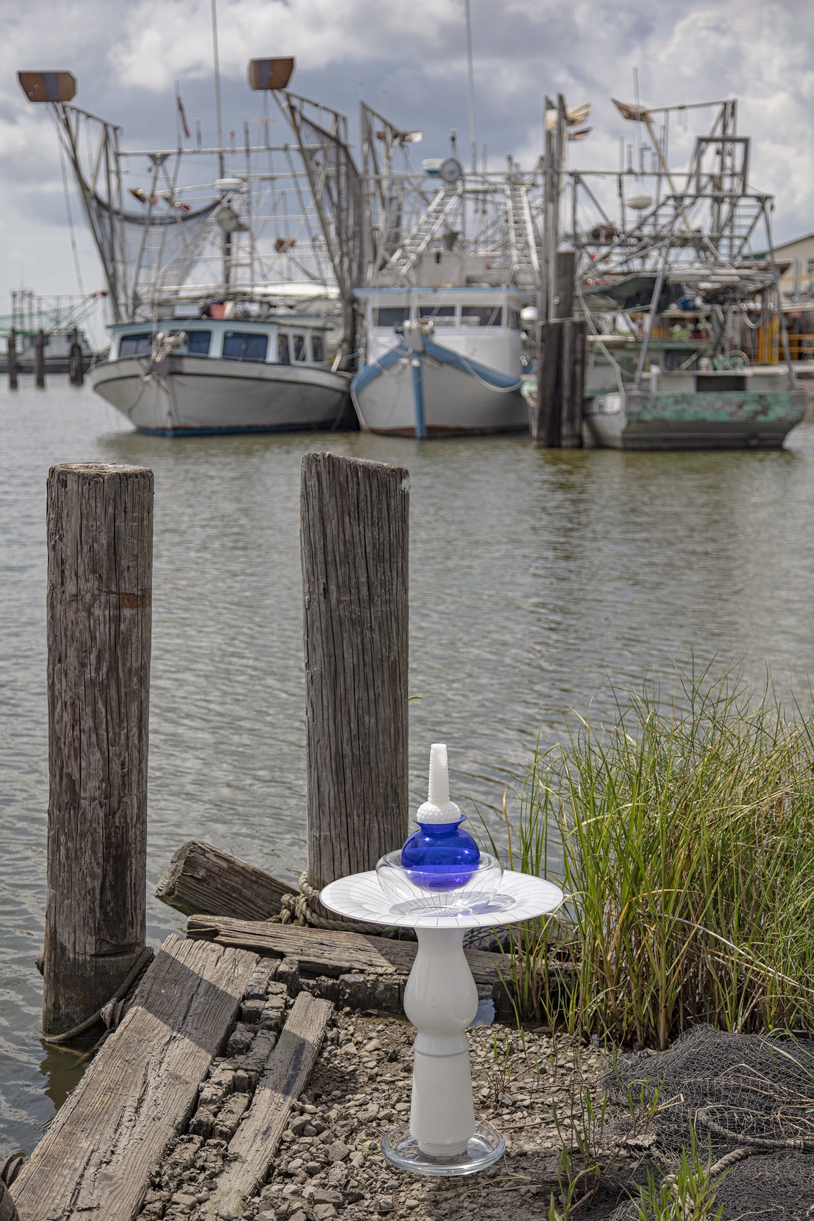
Plaquemine Lock State Park, Plaquemine, Louisiana, July 27, 2021, N30°17'31" W91°15'07.4", Elevation 40 feet
The Bayou Plaquemine waterway connected the Mississippi River and the Atchafalaya Basin to form an inland shipping route for Native Americans and European settlers. In 1909, a series of shipping locks were built to raise ships fifty-one feet—a world record at the time, the engineer then worked on designing the Panama Canal. Alas, in the 1940s, a larger canal was built at Port Allen directly across the Mississippi. This old site was decommissioned but lives on as the Plaquemine Lock State Historic Site, featuring the lock walls, an historic church that has been converted to a museum, and a community park. The tall white cairn sits on one of the boat docks in the park.
In memory of Jeigh Singleton

Burnside, Louisiana, July 27, 2021
N30°08'26" W90°56'11", Elevation 30 feet
The white curlicue cairn poses in front of the historic Houmas House gates. In 1774 Alexander Latil and Maurice Conway appropriated the land from the native Houma people. A succession of owners and approximately 750 enslaved people worked the land to grow sugar cane from 1803 until the Civil War. In 1862 the house was used as the headquarters of Union General Benjamin Franklin Butler. Currently, tours of the mansion and gardens, with guides in period costumes, are offered at this “crown jewel of Louisiana’s river road.”

Between US Highway 61 and Bayou La Trainasse, Lutcher, Louisiana, July 27, 2021
N30°05'27" W90°43'29", Elevation Zero feet
Right off the highway, a loud, high-pitched whistle emanated from large pipes that arch above ground, behind a chain link fence posted with “No smoking” signs. The red-and-white cairn marks nearby smaller pipes poking up in the swampy ground that is at, or slightly below, sea level. What will happen to these utilities when the sea level rises?

Glendale Plantation Road, off the River Road, Edgard, Louisiana, July 27, 2021
N30°01'47" W90°30'41", Elevation 10 feet
The amber cairn stands between rows of sugar cane, the dominant crop in this part of Louisiana. The crops are irrigated by a system of canals, including the Company Canal and the Glen Dale Canal, that carry water from the Mississippi to the fields.

River Road, Luling, Louisiana, July 27, 2021
N29°56'17" W90°21'34", Elevation 20 feet
The mushroom-like cairn rests at the base of a live oak tree in this city park. Children were playing on the swings and climbing structure, while on the other side of the levee, a ship sailed by. In the background, the tops of the Bunge North America and the International-Matex Tank industrial complexes, located across the Mississippi River in Destrehan, Louisiana, are visible.

Audubon Park, New Orleans, Louisiana, July 27, 2021
N29°55'02" W90°08'02", Elevation 20 feet
Many people were enjoying the cooler evening temperatures in this large riverside park. The flamboyant red cairn rests on a fence post between the walking trail and the steeply sloping and soggy river bank.

Jackson Square, New Orleans, Louisiana, July 28, 2021
N29°57'28.5" W90°03'50", Elevation 10 feet
The Rocket Ship Cairn stands sentinel on the stone street next to the historic St. Louis Cathedral while a puddle at its base reflects the adjacent buildings.

Patterson Road, Belle Chasse Marine Transportation, New Aurora, New Orleans, Louisiana, July 28, 2021
N29°53'29" W89°54'38", Elevation 10 feet
A red, amber, and clear glass cairn marks the top of the levee at the private road leading to the “Violet Launch,” that carries workers out to the big rigs and ships. This is near the Audubon Wilderness Park —closed during the summer months—and Tulane University’s A Studio in the Woods.

Marine Road off Highway 23, Port Sulphur, Louisiana, July 28, 2023, N29°37'56" W89°57'07"W, Elevation 10 feet
The Blue Cairn sits on the pier at the Myrtle Grove Marina, looking down the bayou at the luxury homes. This development is unlike the surrounding swampy land that has modest single-family homes.
A sign tacked to the pier instructed visitors to pay $10 to fish from the dock, but a seagull freely fished for goldfish crackers tossed into the water. A month later, on August 29 on the 16th anniversary of the deadly Katrina storm, Ida, another major hurricane, swamped most of coastal Louisiana including this location in Port Sulphur.

Levee Road at West Paula Drive, off Highway 23, Port Sulphur, Louisiana, July 28, 2021, N29°27'02" W89°38'58", Elevation 10 feet
A white-and-clear glass cairn sits in front of a water control structure on the Mississippi River.
Buras, Louisiana, July 28, 2021
N29°21'12" W89°32'11", Elevation 10 feet
A mushroom-shaped cairn rests on the shore of this commercial fishing boat port among old fishing nets, tires, and a mostly submerged boat hull (outside this image). A month later, on August 29, the 16th anniversary of the deadly Katrina storm, Ida, another major hurricane, swamped most of coastal Louisiana.

Venice, Louisiana, July 28, 2021
N29°13'53" W89°23'24", Elevation 10 feet
Google Maps™ identifies this location as “The end of the River Road,” and a sign next to the road proclaims it the “Southernmost point in the state of Louisiana.” This is a fitting place for a sampling of the cairns used to make Watershed Cairns images on the great rivers of the Mississippi River Watershed. Parts of cairns used to mark the Northern Mississippi River, the Ohio River, the Missouri River and its main tributaries are gathered on a log with a view of an island in the Gulf of Mexico beyond. A month later, on August 29, the 16th anniversary of the deadly Katrina storm, Ida, another major hurricane, swamped most of coastal Louisiana, including this site.

Tide Water Road, Venice, Louisiana, July 28, 2021
N29°14'08" W89°23'13", Elevation 10 feet
Near the end of Tide Water Road and the “Southernmost Point in the State of Louisiana,” a white cairn marks the juxtaposition of petrochemical industry and natural environment that is common in the Delta. Behind the white cairn balancing, in the soft, submerged soil, is a Targa Resources plant. Based in Houston, Texas, Targa describes itself on their website as a “provider of midstream services” and “in the business of gathering, compressing, treating and selling natural gas, natural gas liquids, liquified petroleum gas, and gathering, storing, terminating and selling crude oil.” A Fortune 500 Company, they reported quarterly earnings in August 2021 of $3.48 billion. On August 29, 2021, the 16th anniversary of the deadly Katrina storm, another major hurricane named Ida, swamped coastal Louisiana.

July 28, 2021
N29°14'55" W89°22'27", Elevation 10 feet
Tide Water Road, Boothville-Venice, Louisiana
The Blue Cairn is posed at the edge of Tidewater Road, looking west toward the peaceful lake-like Yellow Cotton Bay. To the east of the road, the Sugar Lake Bayou separates into two branches, both snaking southward through the swamps. The Venice and Cypress Cove Marinas are found immediately north of the bayou’s split. North of the marinas, channels have been created for barge access to a dozen industries on McDermott and Haliburton Roads.
A month after this image was created, Ida a category 4 hurricane inundated the Gulf on August 29, the sixteenth anniversary of the deadly Hurricane Katrina.
Tide Water Road, Boothville-Venice, Louisiana, July 28, 2021, 29°14'55"N 89°22'27"W, Elevation 10 feet
The Blue Cairn is posed at the edge of Tidewater Road, looking west toward the peaceful lake-like Yellow Cotton Bay. To the east of the road, the Sugar Lake Bayou separates into two branches, both snaking southward through the swamps. The Venice and Cypress Cove Marinas are found immediately north of the bayou’s split. North of the marinas, channels have been created for barge access to a dozen industries on McDermott and Haliburton Roads.
A month after this image was created, Ida, a category 4 hurricane, inundated the Gulf on August 29, the sixteenth anniversary of the deadly Hurricane Katrina.