
Artists Libby Reuter and Joshua Rowan create Watershed Cairns: Water Marked with Art throughout the Mississippi/ Missouri river basin. They temporarily place and photograph found-glass sculptures, or cairns, to draw attention to fresh water on land ,streams, and rivers.
These images mark Missouri River’s path from the Centennial Mountains in Montana into North Dakota. The journey continues in Missouri River 2, following the Missouri to its confluence with the Mississippi River north of St. Louis, Missouri.

First Peoples Buffalo Jump State Park, near Great Falls, Montana—July 1, 2017
47°29’43”N 111°32’54”W—Elevation 3,840 ft.
The Crystal cairn reflects the setting sun at the edge of the First Peoples Buffalo Jump State Park, northwest of the Missouri River. The park honors the original people and the buffalo, or bison, who originally lived here. Native peoples used this site to hunt wild buffalo for at least a thousand years before the Lewis and Clark Expedition in the early 1800s. The bison jump site is not in this image, but it consists of a mile-long sandstone cliff scarred by tens of thousands of hooves and up to eighteen feet of compacted buffalo remains below the cliff.

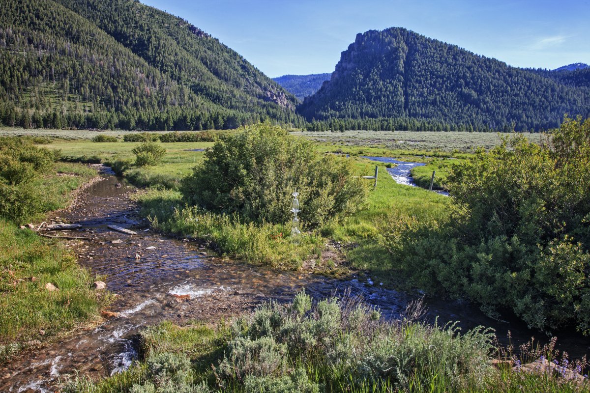
First Peoples Buffalo Jump State Park, near Great Falls, Montana—July 1, 2017
47°29’43”N 111°32’54”W—Elevation 3,840 ft.
The Crystal cairn reflects the setting sun at the edge of the First Peoples Buffalo Jump State Park, northwest of the Missouri River.

Hardy Bridge in the Big Belt Mountains, near Cascade, Montana—July 2, 2017
47°09’59”N 111°50’01”W—Elevation 3,370 ft.
The steel truss bridge spanning the Missouri River on old US Route 91 is listed on the National Register of Historic Places in 2010. Today, most traffic takes the adjacent US highway 15, but 91’s new name, “Recreation Road,” is the perfect description of this road that traces the Missouri River through spectacular Adel Mountain Volcanic Field. The river below welcomes a steady flow of paddlers and floaters.

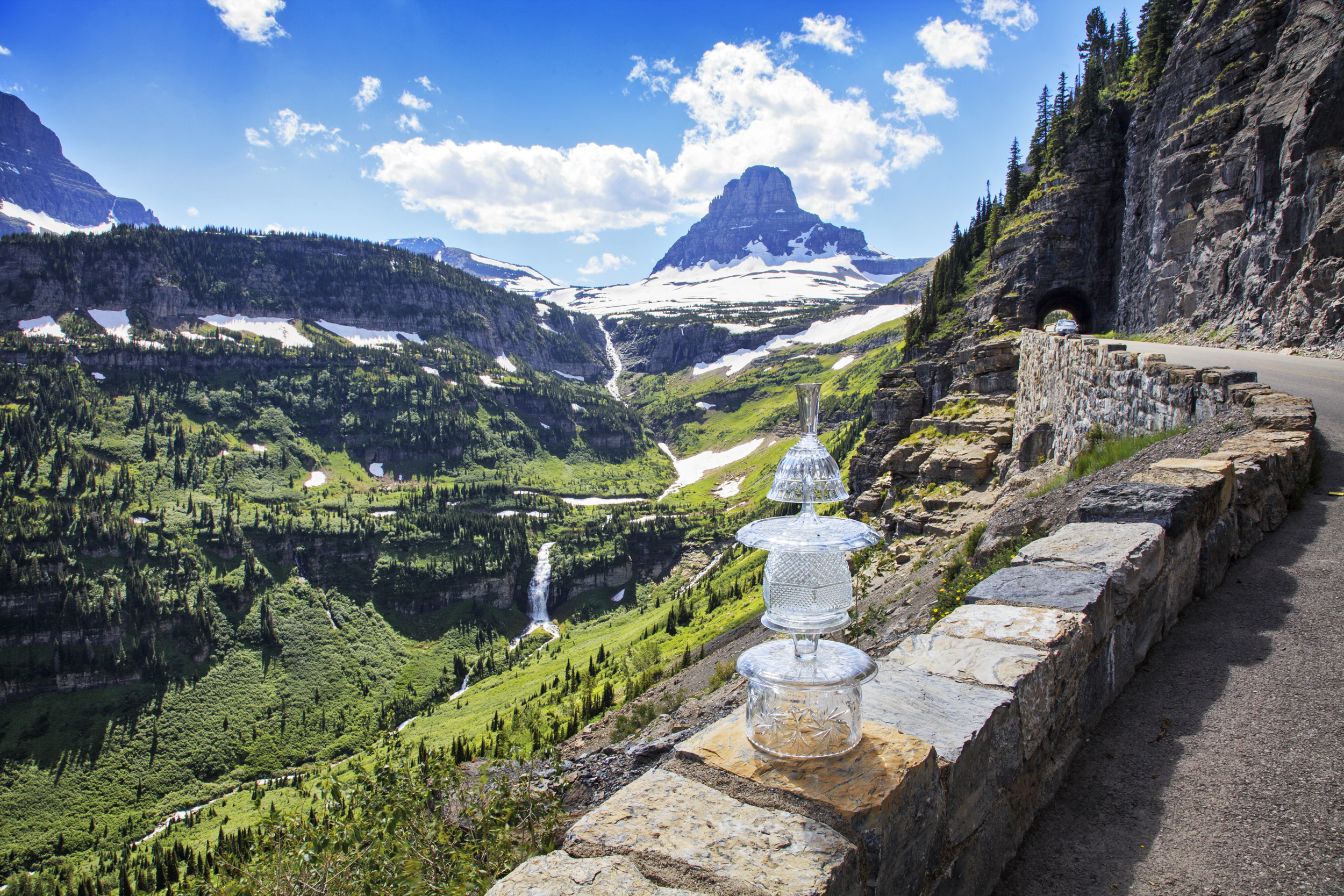
Glacier National Park, Montana—July 3, 2017
48°29’19”N 113°22’03”W—Elevation 5,180 ft.
The Green-gold cairn is resting in a campground between Pray Lake and the larger Two Medicine Lake. East of the park, the Two Medicine River becomes the Marias River, a major tributary of the Missouri River. The cairn is surrounded by flowering “beargrass.” Its scientific name is Xerophyllum tenax and is one of almost 1,000 species of wildflowers in the sub-alpine climate of Glacier National Park. According to the National Parks’ website, beargrass is not a grass and bears don’t particularly like it.
Glacier National Park, Montana—July 3, 2017
48°41’50”N 113°41’34”W—Elevation 6,220 ft.
This cairn marks the Continental Divide, the high places where water on different sides of the mountain flow in two distinct watersheds. This mountain ridge separates the Mississippi River basin, covering the central portion of the United States, from the Pacific Ocean watershed on the West Coast. An observation pull-off on the Glacier National Park’s Going-to-the-Sun Road, looks northeast into the Mississippi watershed, toward the glaciers. The water from their melting feeds Reynolds Creek that becomes St. Mary’s Lake. Marias River, one of the Missouri River’s main tributaries, flows from this lake. Three weeks after this image was created, the Reynolds Creek forest fire burned four thousand acres along the “Going-to-the-Sun Road” near St. Mary’s Lake.

Glacier National Park, Montana—July 3, 2017
48°42’05”N 113°43’04”W—Elevation 6,340 feet
This cairn marks the Continental Divide, the high places where water on different sides of the mountain flow in two distinct watersheds, or basins.

Near Fort Benton, Montana—July 4, 2017
47°48’54”N 110°42’34”W—Elevation 2,920 feet
This cairn sits on the Lewis and Clark Trail. Not an actual road, but a series of historical markers based on the journals that Meriwether Louis and William Clark kept of their journey to explore the new Louisiana Territory and find a route to the Pacific Ocean in the early 1800s This site is about 15 miles downstream from where the Maria’s River, a major tributary, enters the Missouri River.

Loma, Montana—July 4, 2017
47°55’55”N 110°30’20”W—Elevation 2,590 feet
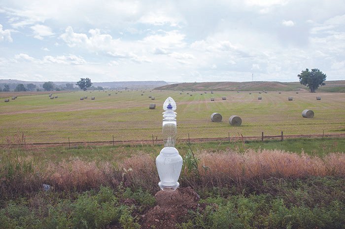
This cairn stands on private property near the confluence of the Teton and Maria’s rivers in the National Wild and Scenic Rivers area. This cairn marks the importance of grain agriculture in the American West and Midwest, showing the importance of clean groundwater and river water for irrigation. Structures that provide safe and dry storage of the harvested grain are seen in the background.
Big Sandy Conservation District, Montana—July 2017
47°44’18”N 109°37’33”W—Elevation 2,400 ft.
On the Judith River, looking west toward the bridge. July 4, 2017

Big Sandy Conservation Area, Montana—July 4, 2017
47°44’18”N 109°37’33”W—Elevation 2,400 ft.
On the Judith River, looking east.

Near Winifred, Montana—July 4, 2017
47°28’05”N 109°21’14”W—Elevation 3,380 ft.
A six-foot-tall, white glass cairn stands on the loading dock of an old wooden grain elevator.

Little Rocky Mountains, Missouri Breaks, near Zortner, Montana—July 4, 2017
47°48’35”N 108°36’32”W—Elevation 3,270 ft.
This image was created after the fire in the Little Rocky Mountains had been burning for 19 hours. It would burn for days and consume 10,000 acres.

Little Rocky Mountains, Missouri Breaks, near Zortner, Montana—July 4, 2017
47°50’32”N 108°30’07”W—Elevation 3,190 ft.
The red glow of the forests burning in the Little Rocky Mountains is the backdrop for a glowing white cairn.

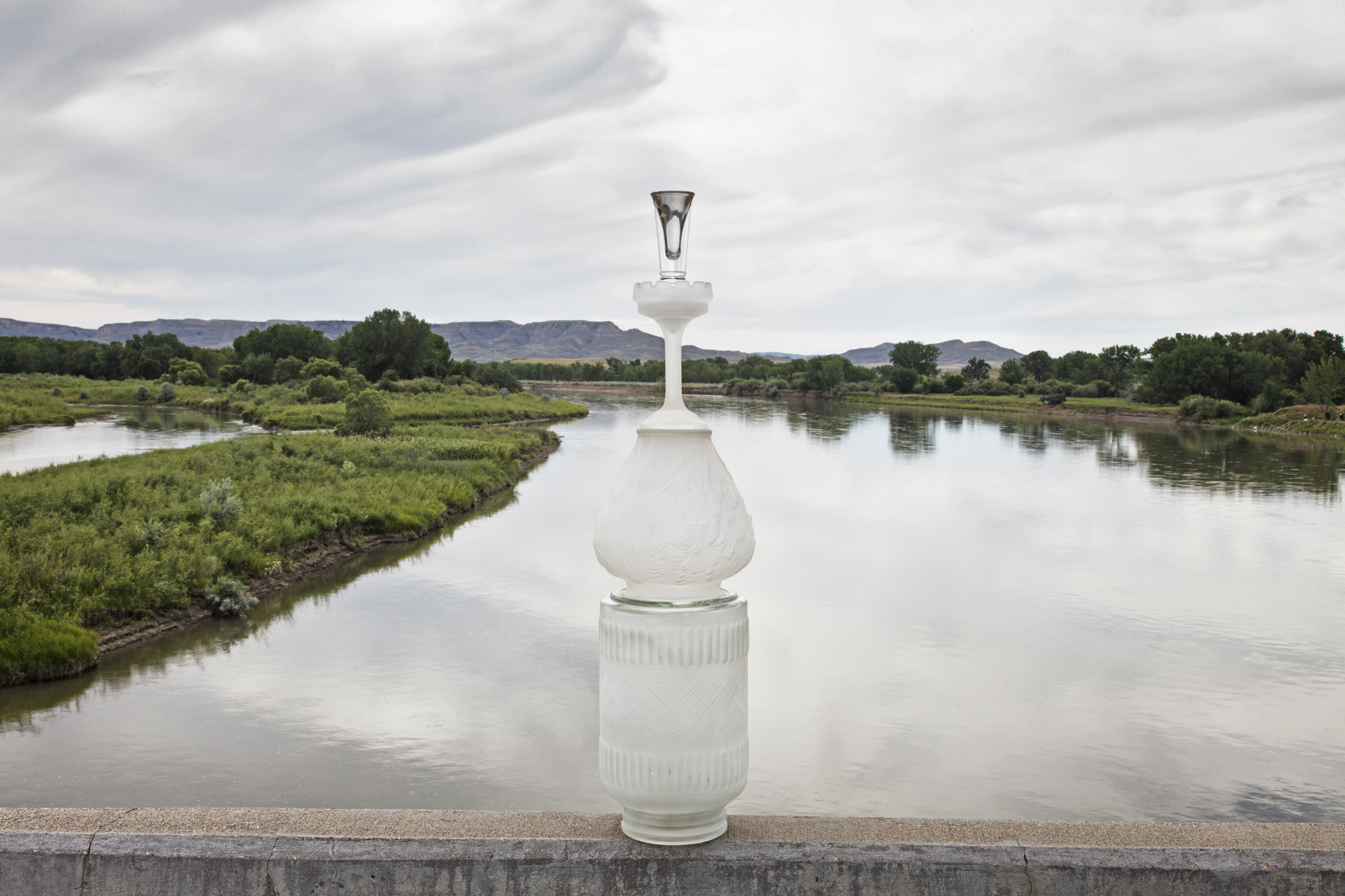
Milk River near Hinsdale, Montana—July 5, 2017
48°23’54”N 107°02’52”W—Elevation 2,170 ft.
Captain Meriwether Lewis, of the Lewis and Clark Expedition, wrote, “From the colour of its water we called it Milk river."

Milk River, near its confluence with the Missouri River—July 5, 2017
Nashua, Montana
48°03’34”N 106°19’06”W—Elevation 1,990 feet
A 5-gallon jug is partially submerged in the slick, muddy water of the Milk River.
Yellowstone River—July 5, 2017
Cartwright, North Dakota
47°5’41”N 103°57’50”W—Elevation 1,970 ft.
The Crystal cairn overlooks the Yellowstone River near a bridge at Cartwright, North Dakota, just a few miles upstream from its confluence with the Missouri River.

Tioga, North Dakota—July 6, 2017
48°11’52”N 103°01’58”W—Elevation 1,940 ft.
Oil rigs and refineries are common throughout North Dakota. In this image, the Crystal Cairn gets up close and personal with an oil drilling rig on 54th St. NW in the Beaver Creek watershed. The creek flows south into Hofflund Bay on the Missouri River.

Parshall, North Dakota—July 6 2017
47°52’23”N 102°07’45”W—Elevation 2,260 ft.
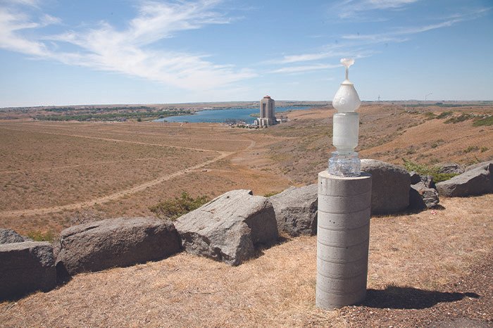
The field of yellow canola flowers on Highway 37 near Parshall, North Dakota, makes a joyous setting for the Geen-gold cairn. The site is east of the Van Hook Arm of Lake Sakakawea, the third-largest man-made lake in the United States. It was created in1956 when the Garrison Dam was built on the Missouri River, midway between Bismarck and Minot, North Dakota.

Garrison, North Dakota—July 6, 2017
47°29’24”N 101°23’26”W—Elevation 1,840 ft.
The waterless spillway of the fourth largest earthen dam on the planet is indicative of how dry 2017 was in the American West. VThe Garrison Dam, pictured here, built as part of the Pick-Sloan Project, the Missouri River flood control and power generation effort, was completed in 1956. The lake that the dam created is named Sakakawea, in honor of the Shoshone-Hidatsa woman who guided explorers Lewis and Clark in the early 1800s. The name is ironic because 1,700 people of the three Affiliated Tribes were displaced after being forced to sell their land for the dam and reservoir construction.

Lake Marie, Medicine Bow National Forest, Wyoming—June 24 2017, With Ryan & Cassie O’Malley.
41°19’54”N 106°19’30”W—Elevation 10,510 ft.
The stream flowing below this cairn empties into the North Platte River, just west of the Medicine Bow National Forest. The Platte is a major tributary of the Missouri River.

Lake Marie, Medicine Bow National Forest, near Laramie, Wyoming—June 24, 2017, with Ryan & Cassie O’Malley
41°19’58”N 106°19’29”W—Elevation 10,510 ft.
An entire side of the mountain behind this translucent cairn is covered with dead Lodgepole pines. The pines were killed by the bites of millions of pine bark beetles. In the past, the numbers of pine bark larvae were kept in check by winter’s freezing temperatures. Thirty days of below-30-degree temperatures would kill most of the beetles, but now, a warming climate keeps the temperatures above freezing even at this higher elevation.

Medicine Bow National Forest, near Laramie, Wyoming—June 24, 2017, with Ryan & Cassie O’Malley
41°20’10”N 106°19’8”W—Elevation 10,570 ft.
The black glass cairn named “False Gods” sits balanced in the melting snow and ice. Water from this pond drains into nearby Libby Creek, and later into the North Platte River, then the Platte River, which is a major tributary of the Missouri River.

Near Centennial, Wyoming—June 24, 2017, with Ryan & Cassie O’Malley
41°08’02”N 106°25’07”W—Elevation 10,570 ft.
The Lantern Cairn sits balanced on a bolder in the middle of the Douglas River while fly fishermen wait for their turn at this fishing hole.

Near Centennial, Wyoming—June 24, 2017, with Ryan & Cassie O’Malley
41°08’02”N 106°25’07”W—Elevation 10,570 ft.
Cairns are often used as memorials as well as trail markers. Here, the lantern cairn is a memorial to Ryan O’Malley’s mother.

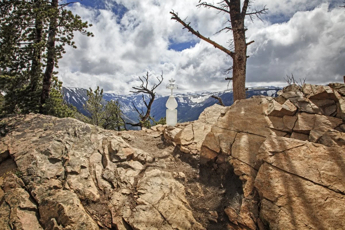
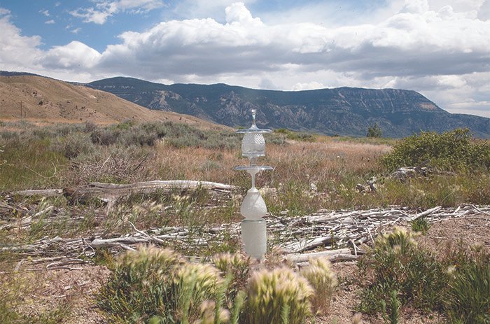
Sinks Canyon State Park, Wyoming—June 25, 2017, with Ryan & Cassie O’Malley
42°44’52”N 108°48’37”W—Elevation 6,420 ft.
The Popo Agie River disappears (sinks) on one side of the mountain, and reappears here.

Pilot Butte Reservoir on the Wind River Reservation—June 25, 2017
Near Morton, Wyoming
43°11’42”N 108°45’39”W—Elevation 5,460 ft.
The Pilot Butte Reservoir on the Wind River provides water for irrigation.

Wind River Reservation, Wyoming—June 25, 2017
42°44’54”N 108°48’34”W—Elevation 6,450 ft.
The Pilot Butte Reservoir on the Wind River is the backdrop for this cairn. Pilot Butte and the nearby Bull Lake and Ocean Lake Reservoirs provide irrigation to verdant, circular fields.

Grand Teton National Park, near Jackson Hole, Wyoming—June 26, 2017
43°58’36”N 110°39’24”W— Elevation 6,860 feet
The shapes of the Crystal cairn, the planes of the mountainside, and the surface of the water in Jackson Lake shimmer with reflected sunlight.

Yellowstone National Park, Montana—June 26, 2017
44°29’11”N 110°00’46”W—Elevation 7,030 feet
The quiet, cooler side of Yellowstone National Park has fresh, clear water in small streams that feed the Yellowstone River.

Buffalo Bill State Park, Wyoming—June 27, 2017
Rocky Mountain Absaroka Range
44°29’45”N 109°17’57”W—Elevation 5,450 feet
The Crystal cairn sits in a firepit next to the Buffalo Bill Reservoir on the Shoshone River.
Buffalo Bill Sate Park, Wyoming—June 27, 2017
44°29’45”N 109°17’57”W—Elevation 5,450 feet
Strong winds and heavy black clouds rushed toward the cairn on the bank of the Buffalo Bill Reservoir.

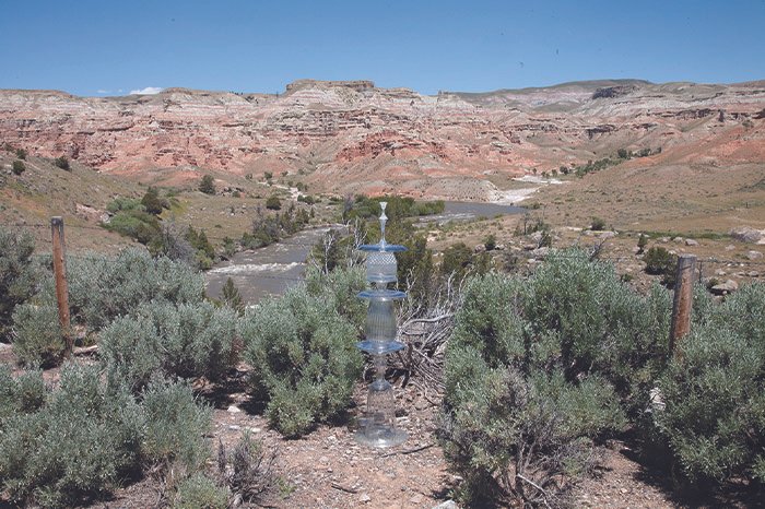
Horseshoe Bend, Bighorn Canyon National Recreation Area, Wyoming—June 27, 2017
44°57’25”N 108°16’40”W—Elevation 3,800 feet
The Green-gold cairn is dwarfed by the iron-red bluffs in the Wild Horse Mountain Range. This location is near the confluence of the Shoshone River, flowing in from the west, and the Bighorn River, arriving from the south. The Bighorn is an extension of the Wind River that flows from the Boysen Reservoir, south of Thermopolis, Wyoming.

Horseshoe Bend, Bighorn Canyon National Recreation Area, Wyoming—June 27, 2017
44°57’25”N 108°16’40”W—Elevation 3,800 feet
The Green-gold cairn is sitting on the iron-red bluffs in the Wild Horse Mountain Range.

Horseshoe Bend,Bighorn Canyon National Recreation Area, Montana—June 27, 2017
45°01’24”N 108°15’07”W—Elevation 4,520 feet
Canyon Overlook Road gives spectacular views of the confluence of the Bighorn River and Porcupine creek to the south. This site provides a birds-eye view of the north-flowing Bighorn River. The river gets its name from the large-horned sheep that early explorers saw on its banks. Bighorn Sheep had been absent from the area for over seventy years when sheep that the Park Service had reintroduced in other mountain areas migrated to this canyon in the 1970s. Since then, the population has grown from fewer than 10 to more than 160.

Horseshoe Bend, Big Horn Canyon National Recreation Area, Montana—June 27, 2017
45°01’24”N 108°15’07”W—Elevation 4,520 feet
The Green-gold cairn nestles in sagebrush near the Horseshoe Bend Observation site, overlooking the Bighorn River.

Near Tongue River Reservoir State Park, Montana—June 28, 2017
45°13’14”N 106°41’55”W—Elevation 3,380 feet
After a rain, horses on the Diamond Cross Ranch graze on the bank of the Tongue River. The Tongue rises in Wyoming in the Bighorn Mountains, flows through northern Wyoming and southeastern Montana, then empties into the Yellowstone River at Miles City, Montana. The Yellowstone is a major tributary of the Missouri River.

Billings, Montana—June 29, 2017
45°46’12”N 108°29’30”W—Elevation 3,110 feet
The False Gods cairn stands over a stream leading to the Yellowstone River near this refinery in downtown Billings, Montana.

Billings, Montana—June 29, 2017
45°46’42”N 108°29’53”W—Elevation 3,110 feet
The False Gods cairn stands in a residential street, leading to a refinery in downtown Billings, Montana.

Pictograph Cave State Park, Four Dances Recreation Area, Montana—June 29, 2017
45°44’34”N 108°26’24”W—Elevation 3,370 feet
A clear cairn poses on a sandstone boulder near hills that house three caves where prehistoric hunters marked their place and time with drawings on stone. Over one hundred images of animals, warriors, and even rifles are exhibited on these walls. The oldest images are more than 2,000 years old. Generations of native peoples used these caves, leaving tools, weapons, wall paintings, and painting instruments. Using art to understand the world is a human endeavor that the contemporary Watershed Cairns artists share with the earlier artists.
Beartooth Pass, Wyoming—June 29, 2017
45°02’37”N 109°24’26”W—Elevation 9,170 feet
Small, fragrant wildflowers grow at the foot of this cairn that appears to touch the sky on Beartooth Highway.

Beartooth Pass, Wyoming—June 29, 2017
44°58’32”N 108°25’37”W—Elevation 10,380 feet
An otherworldly mist envelops the False Gods cairn in the snow, 567 feet below the summit of Beartooth Pass.

Beartooth Highway, Montana—June 29, 2017
44°52’38”N 110°22’53”—Elevation 10,010 feet
Clear lakes reflect a faceted crystal cairn, viewed from the Beartooth National Scenic Byways-All American Road.

Yellowstone National Park, Montana—June 30, 2017
44°52’44”N 110°23’21”W—Elevation 6,850 feet
The Crystal cairn is poised on the stone wall overlooking the Yellowstone River in northeastern Yellowstone Park.

Mammoth Hot Springs, Yellowstone National Park, Montana—June 30, 2017
44°57’55”N 110°42’45”W—Elevation 6,770 feet
The black False Gods cairn contrasts with the white limestone terraces and the colors of the heat-loving microorganisms in Yellowstone National Park.

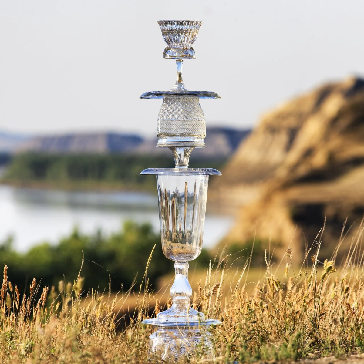
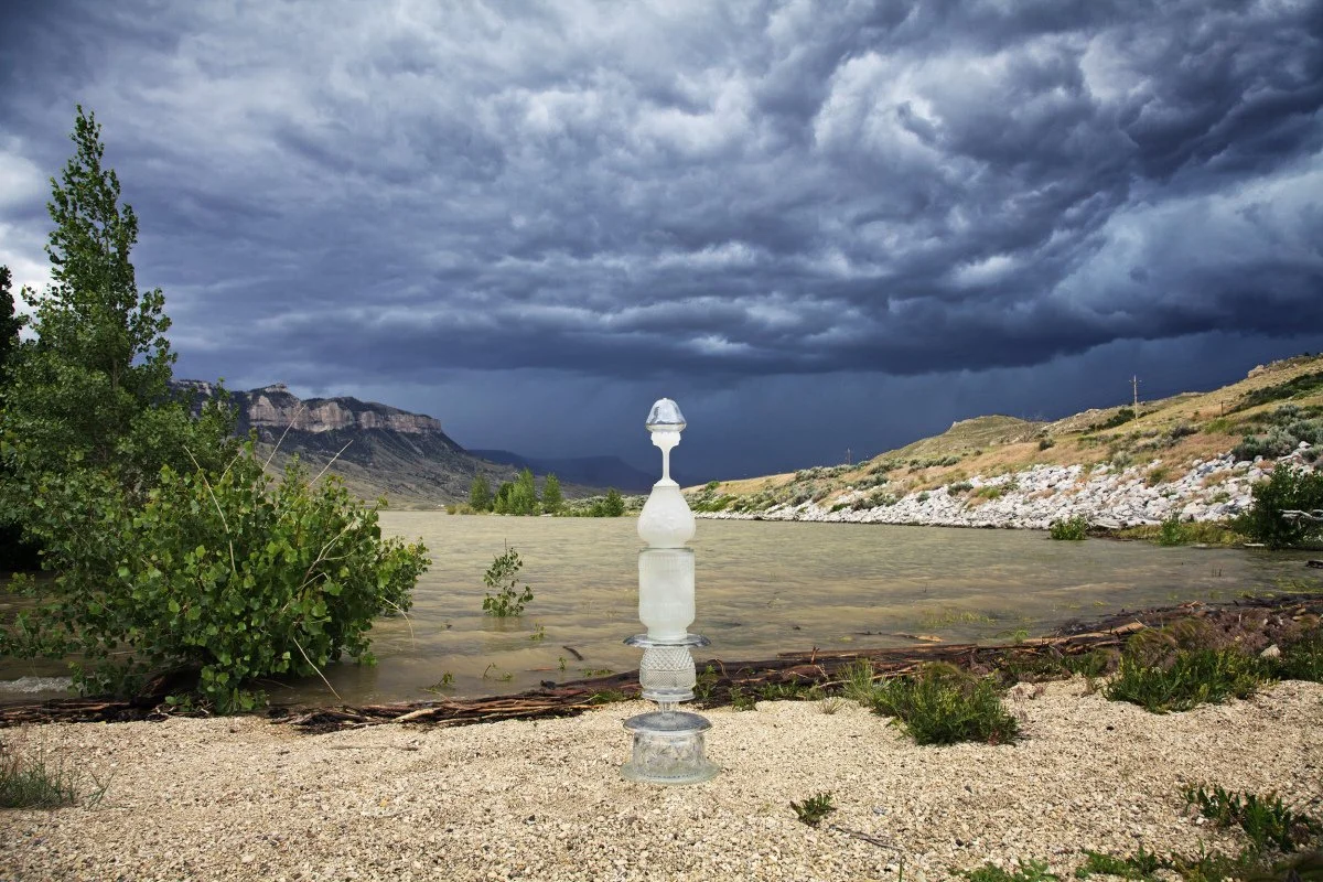
Missouri Headwaters State Park, Montana—July 1, 2017
45°55’33”N 111°30’11”W—Elevation 4,180 ft.
The tallest cairn made on the Missouri River perches on the edge of a steep bluff overlooking the confluence of the Jefferson and Madison rivers. Beyond the frame of this image, the Gallatin River joins its sister-rivers a mile downstream where they become the Mississippi River for the rest of their journey to the Gulf of Mexico. Fed by ninety-five major and many smaller tributaries, the Missouri River travels north, then east, for more than 2,345 miles to join the Mississippi River north of St. Louis, Missouri.

Canyon Ferry Lake Dam, near Helena, Montana—July 1, 2017
46°39’08”N 111°43’53”W—Elevation 3,640 feet
This cairn posed on a picnic table with a great view of the Canyon Ferry Dam and reservoir. This dam is the second of the 15 large dams on the main stem of the Missouri River.
Fort Peck Dam, Nashua, Montana, July 5, 2017
48°00′30 ″N 106°24′01 ″W, Elevation 2,270 feet
The crystal and transparent cain rests high above the bone-dry reservoir of the tallest dam on the Missouri River, near its confluence with the Milk River. The 2017 has been the state’s driest in the past 110 years.
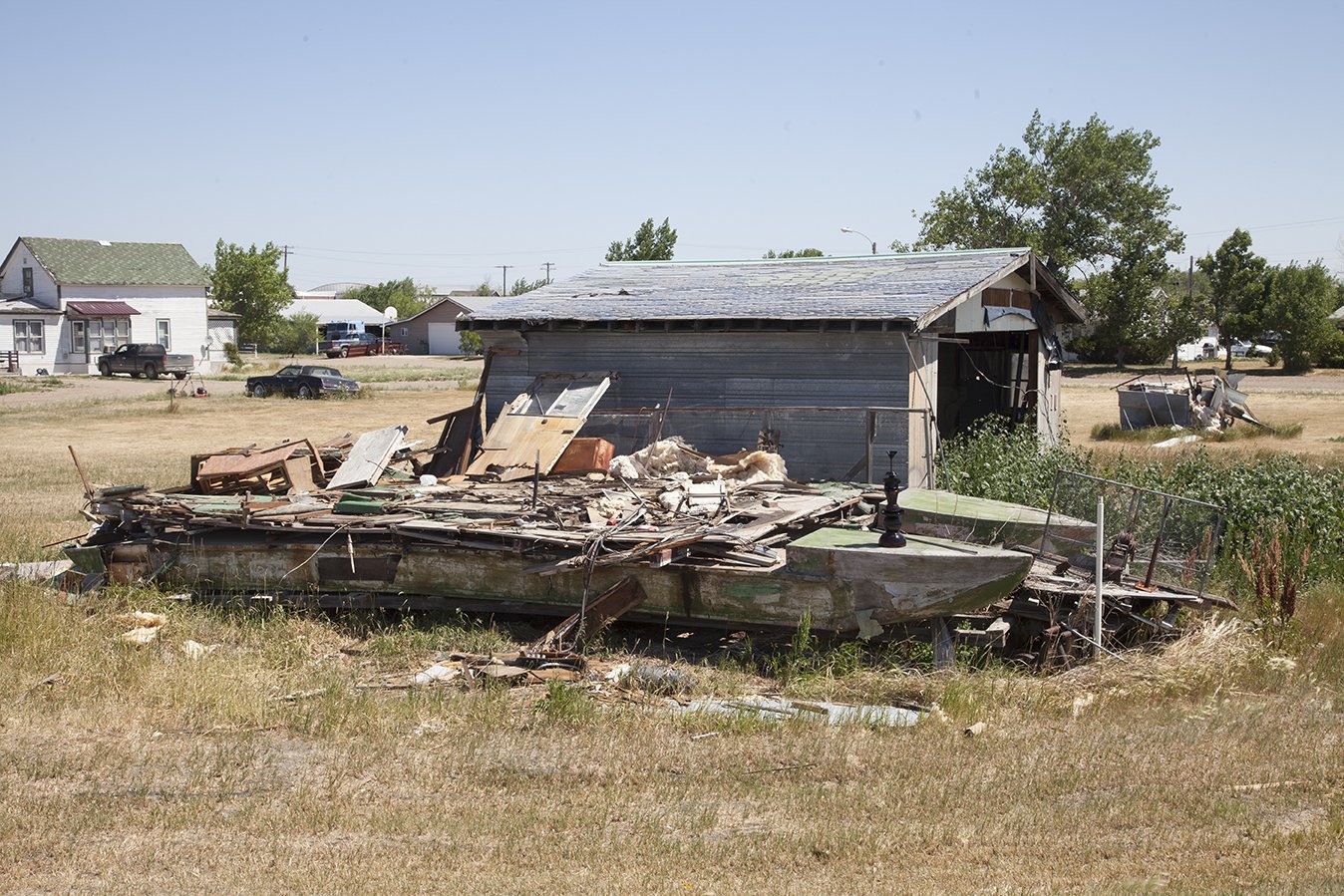
Saco, Montana, July 5, 2017
48°27′29 ″N 107°20′48 ″W, Elevation 2,170 feet
The broken pieces of the black False Gods Cairn sit on a beached, disintegrating pontoon boat. Situated near the corner of US2 and Dead End Road, the boat is three blocks from the shallow Milk River.
Near the Decker, Montana, coal mine, June 28, 2017
45°0′51 ″N 106°51′40 ″W, Elevation 3,470 feet
Trucks rolled by this field on their way to the Decker mine, and a gust of wind toppled and broke the top part of this cairn. As we picked up the pieces, we wondered what effect the coal mine had had on the nearby town of Birney (population 137 in 2010), on local ranchers, or on the Tongue River. The Tongue originates in Wyoming’s Bighorn Mountains, emptying into the Yellowstone River at Miles City, Montana. The Yellowstone is a major tributary of the Missouri River.
Buffalo Bill State Park, near Cody, Wyoming, June 27, 2017
44°29′45 ″N 109°17′57 ″W , Elevation 5,450 feet
This cairn sits on the banks of the Buffalo Bill Reservoir, an 8,315-acre lake formed by the Shoshone Dam, built in 1910 at the confluence of the north and south forks of the Shoshone River. The bending grass in this photo illustrates the strong winds that blow through the canyon in the Absaroka Range making windsurfing a popular sport.
Wind River Badlands, Dubois, Wyoming, June 26, 2017
43°30′39 ″N 109°33′47 ″W, Elevation 6,860 feet
Sagebrush, fences, and endless cattle ranges straddle both sides of the road in the Wind River watershed. Irrigated fields near rivers and reservoirs are less common, but are essential for farms and ranches.
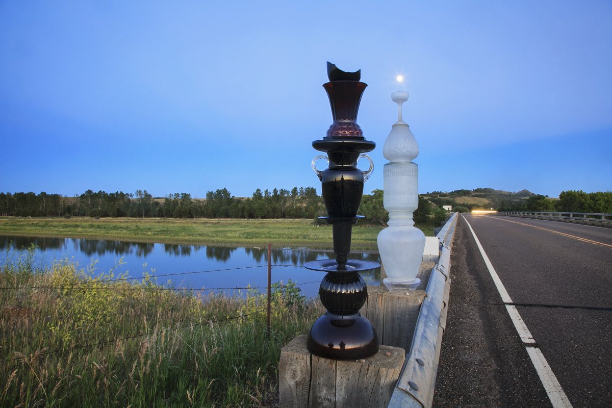
Standing Rock Indian Reservation, North Dakota—July 6, 2017
46°24’58”N 100°38’09”W—Elevation 1,630 feet
The False Gods cairn and the Lantern cairn face each other near the No Dakota Access Pipeline (NDPL) peaceful protest site in 2016-17. The Native Americans and their allies objected to a crude oil pipeline under the Missouri River where the Standing Rock Reservation sources its drinking water.
Hell Roaring Creek, Red Rock Lakes National Wildlife Refuge, Montana—June 30, 2017
44°35’57”N 111°33’0”W—Elevation 6,880 feet
Water, flowing from the mountains in the background, becomes the Jefferson River that joins other rivers at the Missouri Headwaters State Park to become the Missouri River. Hell Roaring Creek then flows west into the Red Rock River, swings northeast to become the Beaverhead River, and finally joins with the Big Hole River to form the river that Lewis and Clark named the Jefferson River in 1805 to honor of the US president. That river joins the Madison and Gallatin Rivers at Three Forks, Montana, where the name changes to Missouri for its 2,400-mile path east, across seven states. The Missouri River joins the Mississippi River north of St. Louis, Missouri, and takes the name Mississippi for the rest of the water’s journey south to the Gulf of Mexico.